Kandieng District (Srŏk Kândiĕng)
Kandieng (ស្រុកកណ្ដៀង) is a district in Pursat province, Cambodia. The district capital is at Kandieng town located about 12 km from the Provincial capital Pursat.
Kandieng shares a border with the districts of Bakan to the west, Sampov Meas to the south and Krakor to the east. The northern part of the district encompasses a portion of the Tonle Sap lake and there is one settlement on the edge of the lake at Reang Til. This is a Tonle Sap floating village and the location moves depending on the water level in the lake.
According to the 1998 Census, Kandieng district is made up of 9 communes and 113 villages. The population of the district was 53,335 in 10,148 households at the time of the last census.
Map - Kandieng District (Srŏk Kândiĕng)
Map


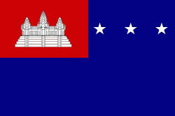
Country - Khmer_Republic
 |
 |
| Flag of Cambodia | |
The main cause of the coup was Norodom Sihanouk's tolerance of North Vietnamese military activity within Cambodia's borders; Vietnamese communist forces had gained de facto control over vast areas of eastern Cambodia as a result. Another important factor was the dire state of the Cambodian economy, an indirect result of Sihanouk's policies of pursuing neutrality.
Currency / Language
| ISO | Currency | Symbol | Significant figures |
|---|---|---|---|
| KHR | Cambodian riel | ៛ | 2 |
| ISO | Language |
|---|---|
| KM | Central Khmer language |
| EN | English language |
| FR | French language |